Did Chinese Junks Round the Cape?
In his fascinating book 1421: The Year China Discovered the World, the former Royal Navy officer Gavin Menzies asserts that a fleet of Chinese junks commanded by Admiral Zheng He rounded the southern tip of Africa more than sixty years before any Europeans succeeded in doing so.
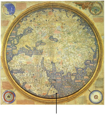
One of the compelling pieces of evidence that Menzies cites in support of his claim is a map of the world drawn in 1459 by the cartographer Fra Mauro, now held by the Biblioteca Nazionale Marciana. It is the first planisphere (map of the entire world) to have been drawn since the days of the Roman Empire. Fra Mauro has correctly drawn the Cape of Good Hope (which he calls Cap de Diab) and did so thirty years before Bartolomeu Dias became the first European to round the Cape.
Fra Mauro also appended notes stating that a ship had rounded the Cape around the year 1420 on a voyage from India. Near this note, he drew a picture of a Chinese junk. Another note describes the huge eggs the crew found when replenishing at Cab de Diab and the giant size of the birds that laid them. That description could have applied only to ostriches, birds unique to southern Africa.
There is no doubt that by the 15th Century, the Chinese had a fleet of ocean-going junks which were extremely seaworthy and capable of making such a voyage. Their very deep, sharp keels gave them great stability, and this, combined with their watertight compartments, made for sturdy ships, capable of sailing the roughest seas. They were also immense, reaching well over 400 feet long and over 150 feet wide. There were several decks below the main deck and several decks above the stern of the ship. They were typically manned by a crew of anywhere between 450 and 700 mariners and they remain some of the largest wooden vessels ever built.
Despite these attributes and the extensive evidence presented by Menzies, historians remain skeptical, believing that the Chinese never sailed very far from land, preferring to hug the coast, even on voyages to the eastern coast of Africa and possibly even to Australia. They dispute Menzies' claim that the ships sailed all the way down the east coast of Africa and then rounded the Cape.
However, there is one more piece of evidence - not mentioned by Menzies - which seems to support his argument: it is a painting of what appears to be a ship in some Khoesan rock art in the Cederberg. The ship bears no resemblance to any of the European vessels which rounded the Cape, but it is a remarkable likeness of one of the huge Chinese junks.
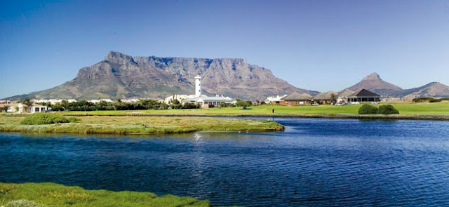
If a fleet of Chinese junks did indeed round the Cape, hugging the coast, one wonders what the Khoesan, congregated on the shoreline near present-day Milnerton, would have made of them. It certainly seems plausible that they would have been so awestruck that they preserved an image of the strange apparitions in their art.


Comments
Post a Comment