Paarden Island and Woodstock Beach
Paarden Eiland (Horses Island) received this name in honour, according to some authorities, of the wild horses or zebras which roamed there in the days of Jan van Riebeeck, or, according to others, of the more familiar donkeys and mules pastured there by the settlers. Van Riebeek’s journals make frequent reference to hunting game in the wilderness around the mouths of the Salt, Black and Diep Rivers, the area now known as Paarden Eiland. The hunters even had to beware of hippopotamus in the rivers! In those days, the Salt River estuary was very wide.
The first skirmish between Europeans and the indigenous Khoekhoen took place on Woodstock Beach. In 1510, the Portuguese sea captain, Francisco d’Almeida, came ashore at the Cape and traded with the locals for cattle. According to legend, the Khoekhoen took some of the Portuguese mariners to a vlei on the Cape Flats, where the herders watered their cattle. Arriving unexpectedly, the men surprised a Khoekhoe princess, who was bathing in the vlei. The sailors helped herd some of the cattle back to Table Bay, but a few of them returned to the vlei the next day, kidnapped the princess and gang raped her. When the Khoekhoen discovered what had happened, they were furious. They attacked the Portuguese on Woodstock Beach, killing their leader and 64 of his men.
As a result of this setback, the Portuguese avoided putting in at the Cape and cut back on their voyages to the East, leaving the passage open for the Dutch East India Company to exploit.
The conclusion of the Khoekhoe legend is worth recounting. Terrified of being molested again, the princess went to live up on the mountain, finding shelter in what is now known as Elephant’s Eye cave. It’s given that unusual name because the mountain is shaped like an elephant and the cave is roughly where the elephant’s eye would be. The cave was formerly known as Princess Cave and the Constantiaberg was previously called Prinseskasteel, so perhaps there is a true story behind the legend.
The poor princess couldn’t stop crying after what had happened to her, and her tears flowed down the mountain to form Little Princess Vlei. According to a local folk tale, every time a man or boy drowns in the vlei, he’s been taken by the princess as revenge. The first all-South African ballet, called Vlei Legend, tells her story. It was first performed in the City Hall in 1952.
 |
| Thomas Bain produced this wonderful painting of Woodstock Beach as it looked c.1847. A lime kiln is visible on the left, as is the Military Hospital, slightly further away. |
 |
| A shell collector's horse and cart on Woodstock beach. Note the bathing boxes on wheels. |
The relative isolation of the Paarden Eiland area from the main residential and commercial centres was put to good use by housing smallpox patients there. Later it was also used as a sewage and waste/refuse dump.
From being a wasteland, the
area gave way to agriculture. Maps of 1786 show well-defined farms. In fact, Paarden
Eiland has served the economic needs of the population of Cape Town in various
guises over the past 350 years. It has gone through five reincarnations – wild
veld, agriculture, industry, commercial, and now retail.
On 11 May 1900, Milnerton Estates received a
request from the South African Cold Storage Company for the letting of a small
portion of land at the north-western corner of Paarden Island at a rental of
£25 per month. Despite considerable hesitation, the transaction not only went
through, but marked the beginning of the area’s industrial development.
Behind a transaction in March 1903 lay a remarkable piece of South African commercial history. Messrs Weil & Co. purchased two blocks of land on Paarden Island on which they proposed to erect “a pier for the discharge of goods”. These goods turned out to be petroleum. In closing the deal, Milnerton Estates recorded: “The Company will give all the assistance it can to promote the interests of the Shell Oil Company”. This step marked the advent of the great corporation in South Africa.
 |
| The pier with its pipeline is just visible in the middle distance. |
It is unclear for how long the pier remained there or when the petrol storage tanks were erected on the coastline nearby, but I clearly remember them from the 1960s, emblazoned with Mobil’s Pegasus logo. Each of the larger tanks holds 2,400m³. Today, the Paarden Island facility is rented to Totalgaz SA and FFS Refiners. The tanks are generally empty, except for four tanks which are leased to FFS Refiners for the storage of used oils.
 |
| The Paarden Island petrol tanks, which for many years were separate from the industrial development closer to town. |
The Cape Town City Council
began construction of the Marine Drive in 1916. This was very different from
the Marine Drive of today: seawater flooding, sand, seaweed and flotsam were common
hazards on the road.
 |
| The original Marine Drive is visible at the water's edge, badly eroded by the sea. |
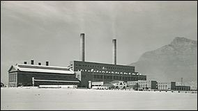
In 1921, the Railway Administration selected a proposed a site for the construction of a power station at the mouth of the Salt River, about 3,5 km from the centre of the city. It comprised roughly 10 ha of Crown land, much of which was below the high-water mark, and 1,8 ha of private property belonging to Milnerton Estates Ltd. There was already a power station in operation at the old Dock Road, which had opened in 1904, but it generated insufficient power for the developing city. Construction was completed for trial start-up in February 1928.
 |
| Salt River 1 |
World War II and the commissioning of the Council’s Table Bay Power Station in 1939, meant that no further additions to Salt River Power Station were contemplated before 1947. To meet the increasing demands for power after the war, Eskom built a new station on the site adjoining the existing Salt River Power Station, the new station being known as Salt River 2. Power was generated for the first time on 27 April 1955.
 |
| Salt River 2 |
The location of the power stations next to the Salt River estuary was important because fresh water supplies are scarce in Cape Town and sea water could be used for cooling. During the years of highest generation, 1967 to 1977, Salt River 1 and 2 Power Stations circulated approximately 300,000 megalitres of sea water annually. If fresh water had been used in the cooling towers, about 4,000 megalitres per annum during these years would have been lost in evaporation. The cold sea water of Table Bay also improved the efficiency of the stations and would have saved more than 100,000 tons of coal over the operating lifetime of Salt River 1 and 2 stations.
On 12 November 1979, a closing ceremony for Salt River 1 was held in the turbine house. In the fifty-one years that it was in operation, its boilers burnt nearly 3,3 million tons of coal and 4,910 GWh of electricity were sent out. By comparison, Koeberg Nuclear Power Station has produced more than double that amount in a single year. The official closing ceremony for Salt River 2 was held at the power station on 12 August 1994. In its forty years of operation, Salt River 2 had burnt over 13,2 million tons of coal and sent out 24,762 GWh of electricity.
Paarden Eiland was only actively promoted and proclaimed an industrial area in 1935, but it developed rapidly after World War II. In 1947, the national government annexed the entire industrial area from Milnerton Estates, and that same year, the Paarden Eiland Industrialists and Ratepayers’ Association was founded by Louis Glassman, a prominent property and business owner in the area.
At first, smaller production units proliferated; then the warehousing, distribution and servicing of finished goods became prevalent. As industry waned, commercial activity replaced it. In the last few years there has been a growth in mini-factories and a retail trade element.
 |
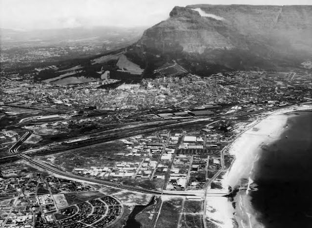
| The early days of the industrial development of Paarden Island. The new Salt River canal separates Paarden Island from Brooklyn, where the crescent-shaped housing development is visible. |
In the early1970s, the decision was made to expand Cape Town harbour to include a terminal for container ships. Dredging work began to accommodate the deep hulls of these ships, with the sand removed in this process being used for landfill on Woodstock Beach. it was supplemented by sand dredged from the Rietvlei marina.
 |
| Dredged sand being used for landfill to create the Container Terminal. |
 |
| The Ben Schoeman Container Basin, with the reclaimed land clearly visible. |
 |
| A plan of Cape Town Harbour, showing the Ben Schoeman Container Basin highlighted in peach. |
This development buried Woodstock Beach under tons of concrete. A railway line linking the terminal with Montague Gardens further cut this area of coastline off from public access.
 |
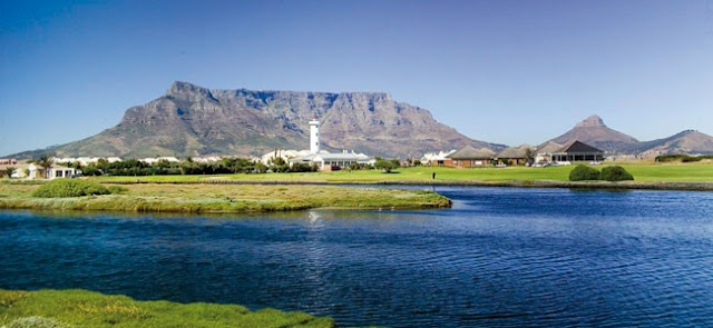
| The coastline as it looks today. |
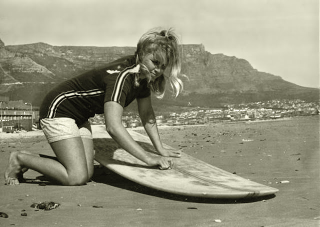
As a result of these developments, scenes like those pictured below are sadly now a thing of the past.
 |
| Woodstock Beach, now buried under concrete. |


I remember surfing in front of the power station. Gone today
ReplyDelete